CIV5314 · TEAM 3 · PUBLIC STORY MAP

A mobility hub is more than a station.

It is the whole journey between the platform, the street and the neighbourhood.

Explore four Istanbul hubs →
800 m
complete neighbourhood
400 m
mixed-use core
transfer

THE QUESTION

Why do some interchanges feel seamless while others feel exhausting?

Istanbul already has metros, ferries, trams, Metrobus and regional rail. The missing piece is often the land between them: crossings, entrances, public space, shops, housing and shade.

4contrasting hubs
400 mtransfer core
800 mdaily-life catchment
1 ruledesign the full journey

FOUR PLACES, FOUR PROBLEMS

Four hubs reveal four different land-use challenges.

All four cases are presented below using the same 400 m transfer core and 800 m neighbourhood lens.

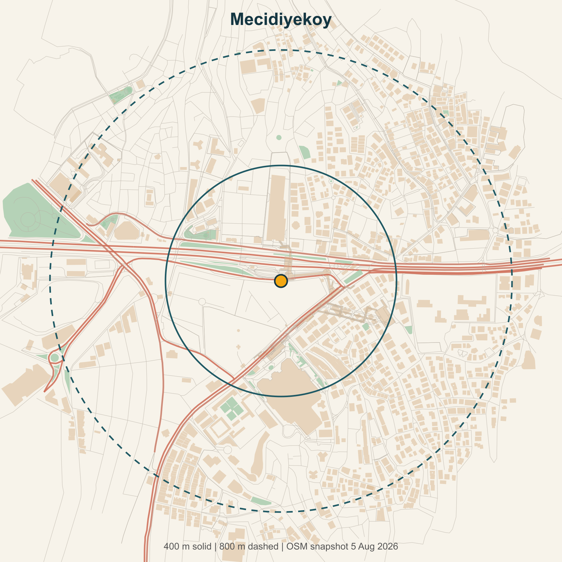
Map of Mecidiyeköy showing 400 and 800 metre study areas
Mapped buildings, streets and open space within common study radii.
01 / 04

Make room

Mecidiyeköy

CBD overload

M2 metro · M7 metro · Metrobus · buses

A powerful metro and Metrobus interchange sits inside a dense business district. The problem is not a lack of activity—it is too many people and vehicles competing for too little transfer space.

  • 334 mapped destinations
  • 2.9% green/open space
  • 7.14 km/km² major roads
What should change?

Widen the pedestrian transfer spine, spread station entrances and move loading activity away from the busiest walking routes.
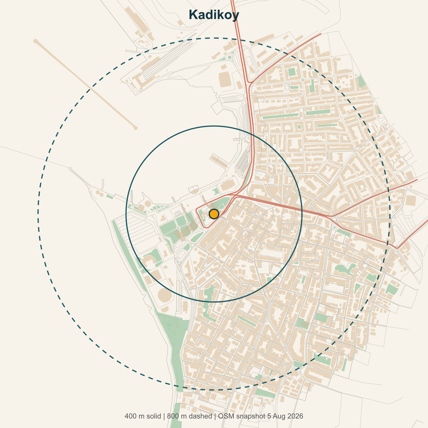
Map of Kadıköy showing 400 and 800 metre study areas
Mapped buildings, streets and open space within common study radii.
02 / 04

Protect what works

Kadıköy

Waterfront centre

M4 metro · T3 tram · ferries · buses

Ferries, metro, tram, markets and public waterfront already work together. Short blocks and lively streets make transfers feel like part of everyday city life.

  • 1,548 mapped destinations
  • 8.82 km/km² walk/cycle network
  • 2.07 km/km² major roads
What should change?

Protect small shops, public waterfront access and walking routes while organising buses, taxis and deliveries more carefully.

Map of Söğütlüçeşme showing 400 and 800 metre study areas
Mapped buildings, streets and open space within common study radii.
03 / 04

Set rules first

Söğütlüçeşme

Regional gateway

Marmaray · high-speed rail · Metrobus · buses

Marmaray, high-speed rail and Metrobus give this hub regional reach. Yet railways, stadium land and large sites make nearby neighbourhoods harder to reach than the map suggests.

  • 12.36 km/km² walk/cycle network
  • 7.64 km/km² major roads
  • 8.2% green/open space
What should change?

Guarantee public through-routes, small blocks, civic space and affordable uses before approving major redevelopment.

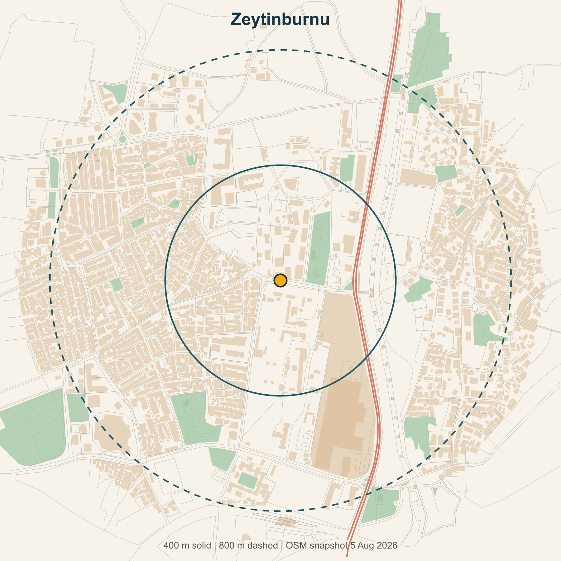
Map of Zeytinburnu showing 400 and 800 metre study areas
Mapped buildings, streets and open space within common study radii.
04 / 04

Stitch it together

Zeytinburnu

Corridor retrofit

M1 metro · T1 tram · Metrobus · buses

Metrobus, metro and tram are close together, but roads and leftover infrastructure spaces divide them. High building intensity has not created an easy walking network.

  • 33.9% building cover
  • 2.91 km/km² walk/cycle network
  • 51.2 junctions/km²
What should change?

Create a green civic connector with safer crossings, accessible routes and community services on reused land.

WHAT SHAPES A GOOD HUB?

Land use changes the cost of every transfer.

Tap a factor. The message is simple: density helps only when people can move through the area safely and comfortably.

Walking access

Short, connected routes turn a nearby station into a genuinely usable one.

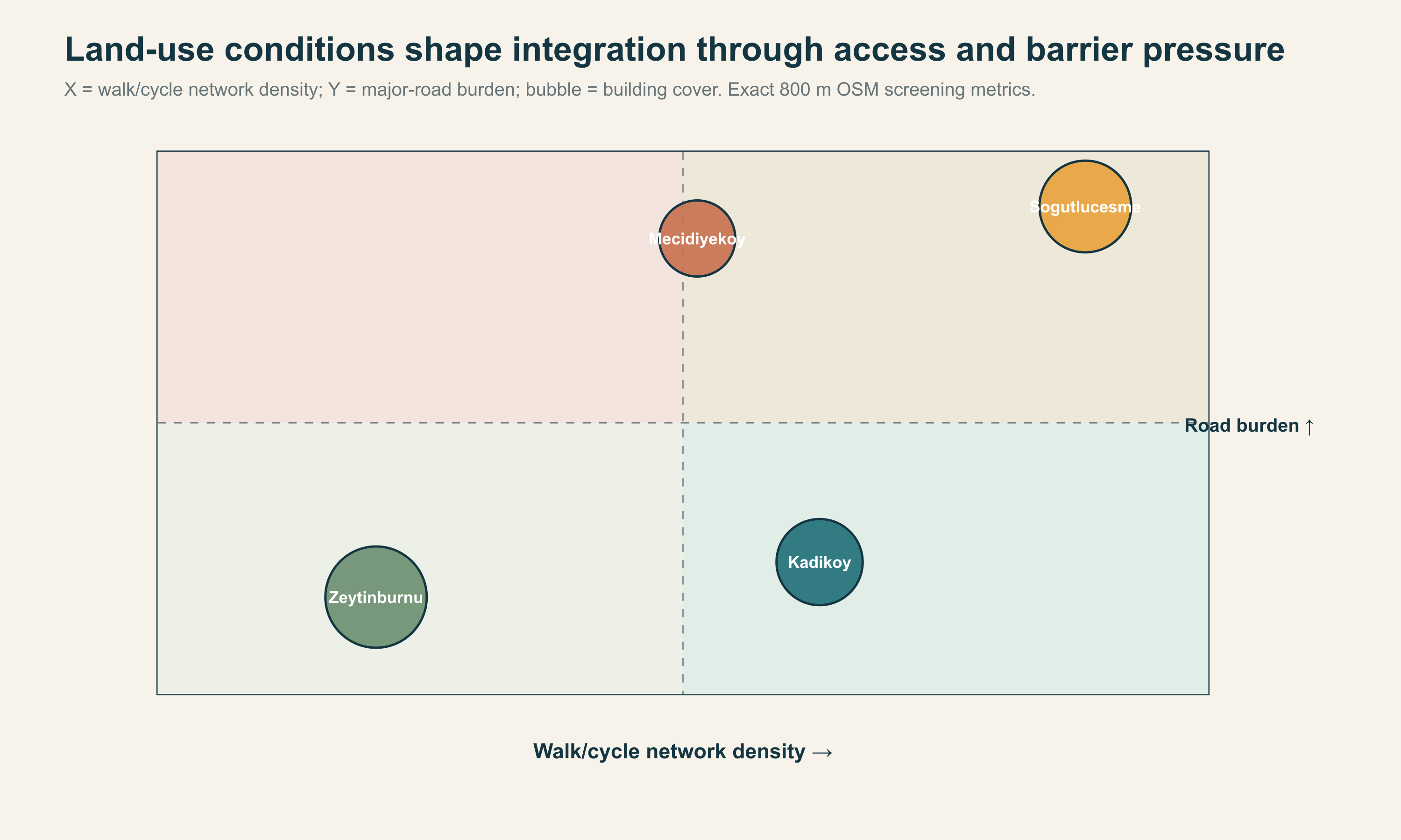
Chart comparing walking network density, road barriers and building coverage across four hubs
This chart compares spatial pressure—not passenger satisfaction or ridership.

THE IDEAL PATTERN

Put the easiest transfer at the centre of a complete neighbourhood.

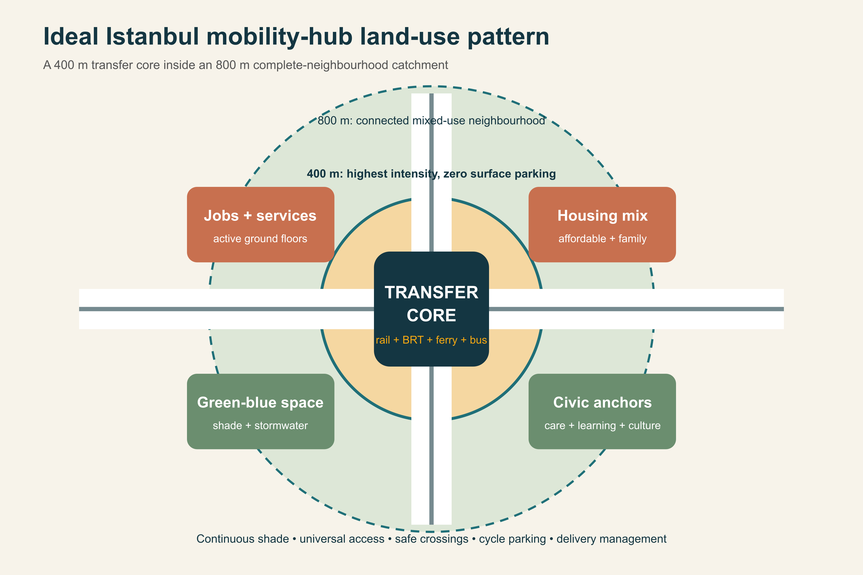
Ideal mobility hub pattern with transfer core and complete neighbourhood
0–100 m

Step-free routes, clear signs, shade, toilets and room to wait. No surface parking in the transfer core.

100–400 m

Homes, jobs, shops, care and public services around several entrances—not one enclosed mega-project.

400–800 m

Affordable housing, schools, parks and safe walking and cycling routes for everyday life.

BOSPHORUS FOCUS

The ferry is only the middle of the journey.

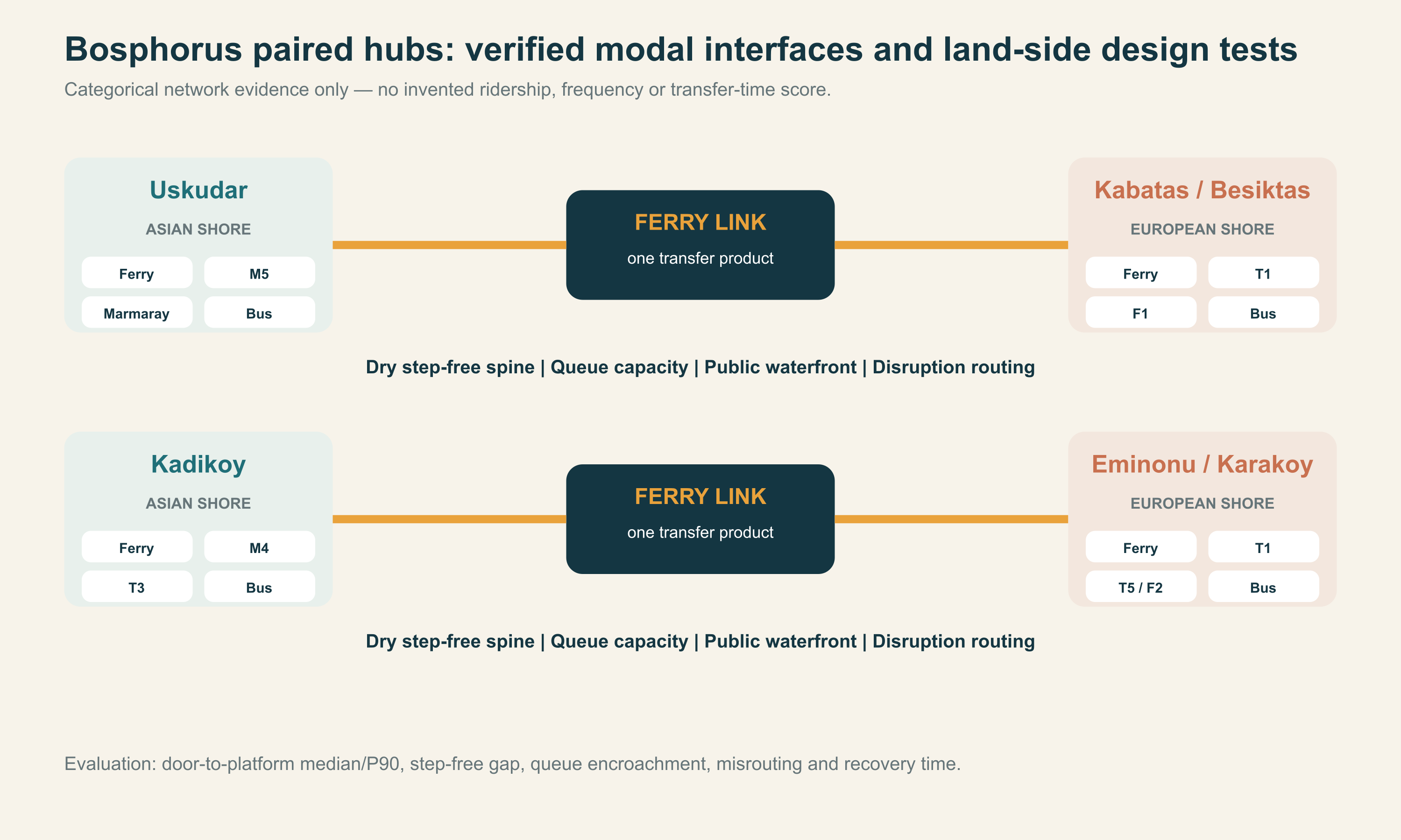
A cross-strait trip succeeds only when both shores work as one hub.

Paired Bosphorus hubs showing ferry, metro, tram and bus connections on both shores
One clear route

A dry, step-free path from ferry gangway to metro, tram or bus.

Room for real peaks

Queues, walking and waterfront life need separate space.

One operating product

Shared departure information, accessible-route status and disruption advice.

WHAT ISTANBUL CAN DO FIRST

Start with the binding constraint—not the biggest building.

01Mecidiyeköy

Make room

02Kadıköy

Protect what works

03Söğütlüçeşme

Set rules first

04Zeytinburnu

Stitch it together

Better access should not push out the people and local businesses that depend on it.

Protect affordability · public space · universal access